Map view
Displaying species observation records
When you search in map view, species observation records will be displayed as clusters of points.
As you zoom in, the clusters will split apart to show more detailed locations. (However, if multiple observations have been recorded at the same location, that cluster will always display the total number of observations.)
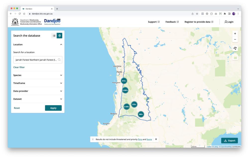
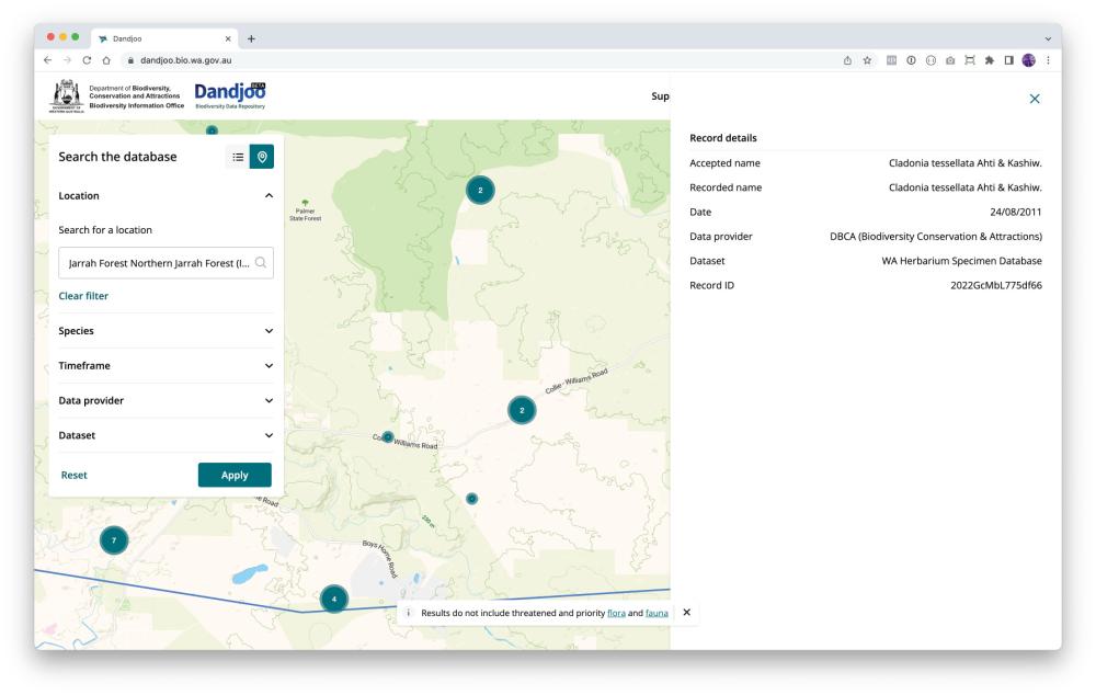
If you would like to view more information about a record, or a cluster of records, just click on it to expand the information panel.
Note that the information panel will only display when you have zoomed in closely to the records you are interested in.
Displaying overlays
Data is more useful with context. We provide a number of overlays you can display on the map, largely sourced from the Western Australia’s open data portal, Data WA.
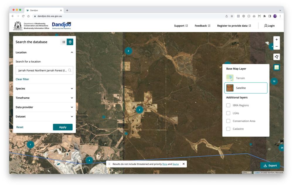
Current overlays in Dandjoo
- IBRA Regions: Bioregions based on the Interim Biogeographic Regionalisation for Australia (IBRA) framework. These regions are key to environmental planning and assist ecological understanding of the land. Interim Biogeographic Regionalisation for Australia (IBRA), Version 7 (Regions) is developed and provided by the Australian Government.
- Local Government Areas: Local government administrative boundaries for gazetted towns, councils, and shires. (Landgate dataset LGATE-233).
- Conservation Areas: Shows DBCA’s ‘Legislated Lands and Waters dataset’, including areas protected under the CALM Act (1984), Swan and Canning Rivers Management Act (2006) and the Land Administration Act (1997). (Department of Biodiversity, Conservation and Attractions dataset DBCA-011).
- Cadastre: The cadastre is a simplified representation of all land parcel boundaries in Western Australia. It provides land ownership information frequently used for property and planning purposes. It is an extremely detailed overly, so you will need to zoom in to see the details. (Landgate dataset LGATE-002)
- Mining Tenements: Shows live tenements in green and pending tenements in blue. Please note that simply because a tenement exists, it does not mean that mining activity is occurring. (Department of Mines, Industry Regulation and Safety dataset DMIRS-003)
- Pastoral Leases: Pastoral leases are leases over Crown land giving a lessee the right to graze livestock on natural vegetation. (Department of Planning, Lands and Heritage dataset DPLH-083)
- Ramsar Wetlands: Boundaries of the nine wetland areas in Western Australia listed as Wetlands of International Importance under the Ramsar Convention. (Department of Biodiversity, Conservation and Attractions dataset DBCA-010)
Viewing vegetation associations
We also provide a vegetation association overlay. Click ‘Vegetation’ in the layer menu to display this layer.
(Note that this is a very detailed overlay, so you may need to wait for it to load depending on your connection speed.)

Dandjoo currently displays submitted vegetation association data as a simple overlay. However, BIO is currently exploring alternative ways of presenting this data in future releases to enhance searchability and navigation.
Drawing your own search area
There are two ways to draw your own search area in Dandjoo’s map view. On the right of the screen, click the ‘Draw a filter’ box and choose one of the two options, polygon search or point search.
Polygon search: Click a series of points to define an enclosed shape. You can also activate and move individual points of your polygon by clicking on them.

Point search: Click on the map to define the centre of your search area and drag your cursor to expand the search area - the radius of the circle is shown as you draw.
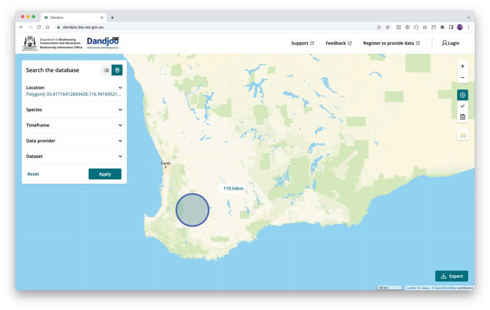
Once you’ve defined your polygon or circle, click the ‘tick’ icon to finalise your search area.
To start again, click the bin icon. (Note that if you have clicked the ‘tick’ icon to lock in your search area, you will need to click the ‘Reset’ button to clear search results.)
Chapter from guidelines, services and standards
Join the BIO newsletter and get updated first
Sign up for access to the latest developments at the Biodiversity Information Office, upcoming Dandjoo features, and our newest datasets.