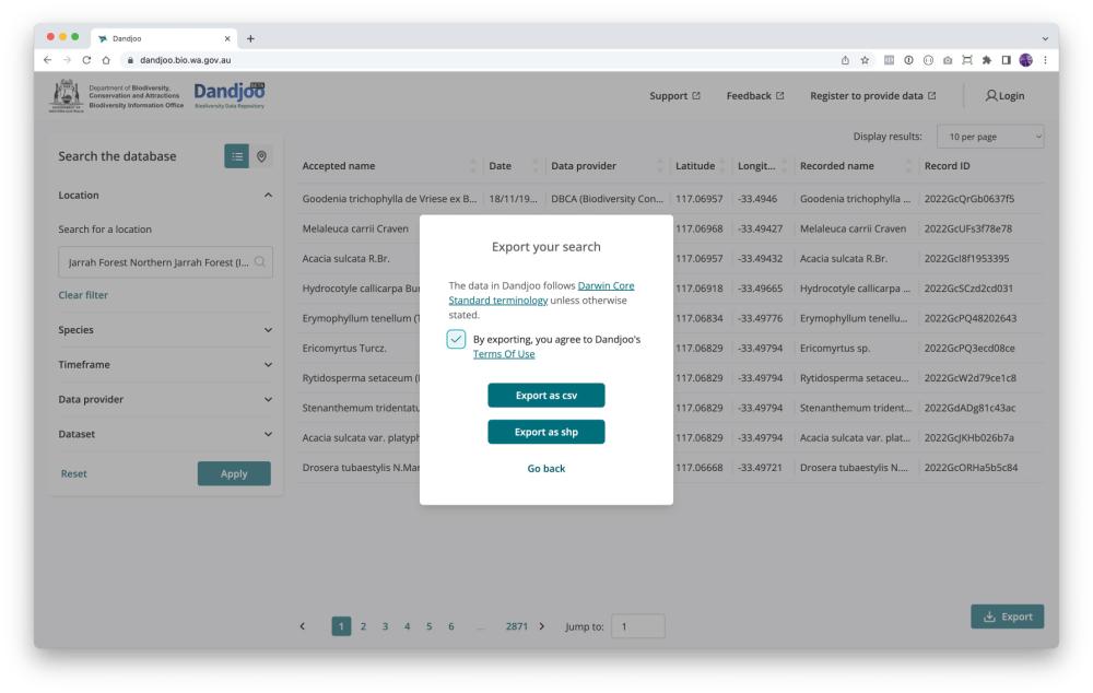
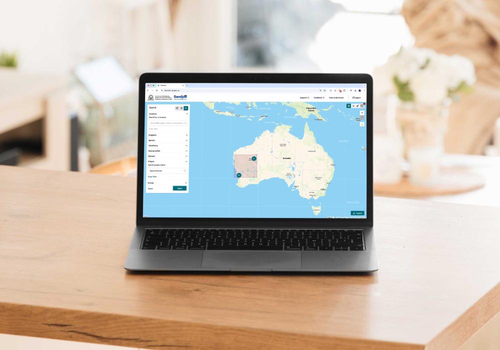
The Dandjoo interface
If you’re using Dandjoo for the first time, check out the information below to learn more about the various elements of the Dandjoo desktop interface:
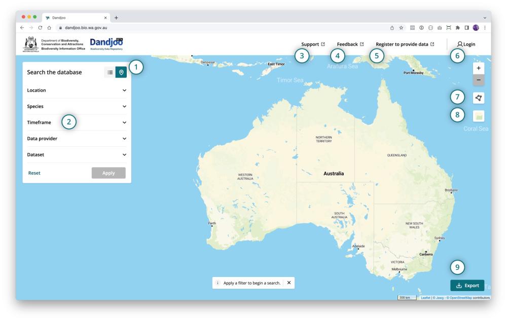
- Toggle between map and table view: View search results on a map, or in a summary table.
- Search filters: Use filters to narrow down your search by location, species, timeframe, data provider, or dataset. (See more at Searching Dandjoo.)
- Get support: Check out our user and data provider documentation.
- Provide feedback: Get in touch with us via our contact page.
- Register to provide data: Sign up to become a data provider. (See more in our Data Provider Toolkit.)
- Log in as a registered data provider: Visit the data submission interface if you are a data provider.
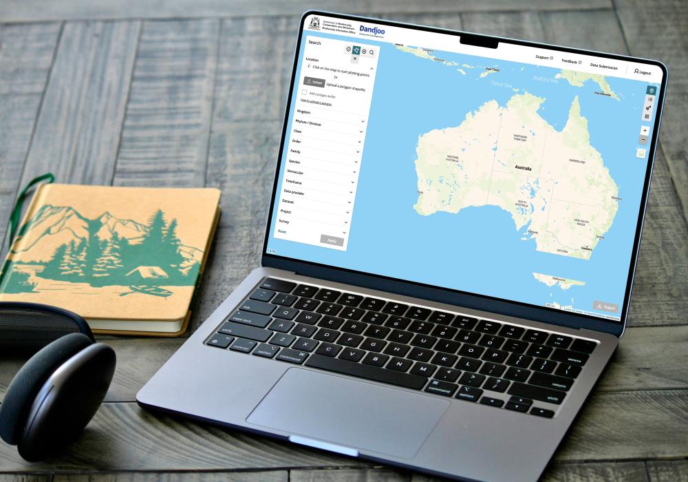
- Draw your own search polygon or circle: Use our drawing tools to define your own search area.
- Customise your map view: Change the base map or view additional layers. (See more at Map view and Table view.)
- Export data: Download your search results as a .csv file or Shapefile. (See more at Downloading the data.)
Using the mobile view
Dandjoo is optimised for desktop view in Chrome and Safari browsers, and also performs well in Edge and Firefox.
However, we do provide a mobile interface that offers a selection of key features available on desktop.
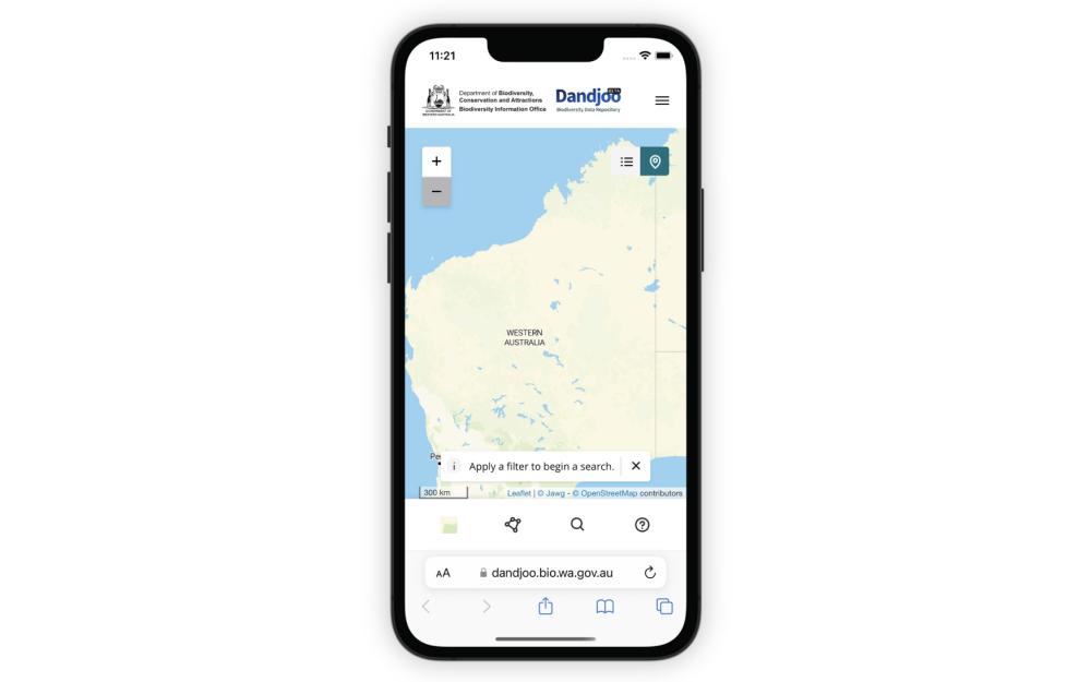
If you are using Dandjoo on a mobile device, you will still be able to search, access map and table view, and use layers. However, to export your search results or submit data, you’ll need to visit the desktop site.
Searching Dandjoo
Search options
Dandjoo currently allows users to search and filter species observation records by five main attributes:
- Location: Search by Local Government Area, IBRA region, or Conservation area. Alternatively, you can draw your own search area - see the Map view section of this page for more information.
- Species: Search by genus or species. Further information about searching by taxonomic name is provided below.
- Timeframe: Search for observations that were made between a start date and end date.
- Data provider: Search for data provided by a specific organisation or individual (as submitted by the data provider).
- Dataset: Search by dataset name (as submitted by the data provider).
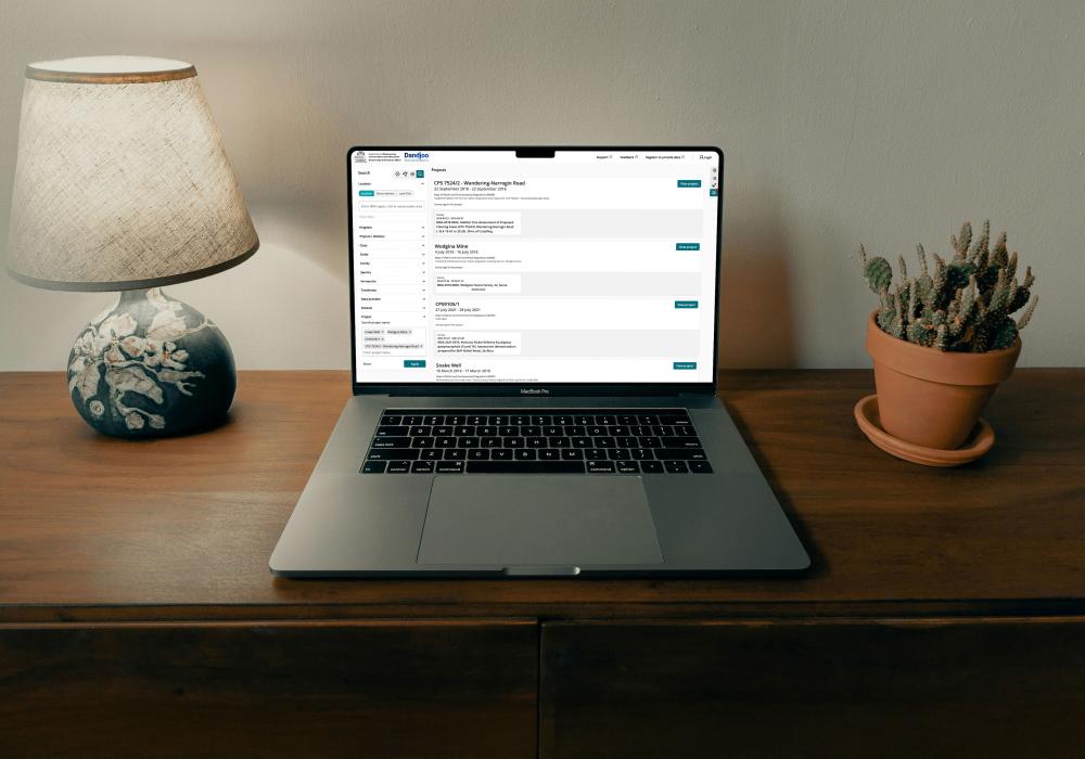
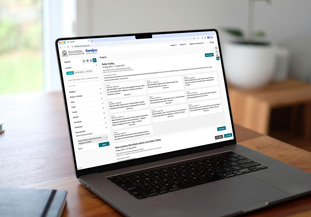
- Project: Search by project name (as submitted by the data provider).
- Survey: Search by the survey name (as submitted by the data provider). Each survey is associated with a project.
You can search using multiple filters, but note that only one value can currently be entered per filter (for example, you may only enter one species name or data provider).
Enhancing search is a priority for future releases of Dandjoo, so do get in touch if you’d like to suggest a feature or refinement.
Searching by species name
Species names may change over time as researchers understand more about evolutionary relationships between taxa.
This can be a challenge for biodiversity database managers, as the name provided by a data submitter represents a point in time, and does not capture synonyms.
BIO has worked to provide an enhanced search experience that accounts for this limitation. The information below explains how Dandjoo handles taxonomic names, and how these are used in search.
Searching and taxonomic names in Dandjoo
- Search by taxonomic rank: You can search by genus or species in the ‘Species’ field, and Dandjoo will return any results containing your search term. At launch, Dandjoo does not support searching within a species higher ranks, but if a record is submitted and only identified at a higher rank it will be searchable.
- Common names: Dandjoo is searchable by any species or genus name recognised in Western Australia, but does not currently provide a common name search.
- Recorded and accepted names: When you enter a value in the ‘Species’ field, Dandjoo will search both the name originally recorded by the data provider, and the accepted (current) name appended by BIO and return all records. Note that the accepted name is applied based on the best information available at the time from the Western Australian Herbarium and Western Australian Museum. However, in some cases BIO may not be able to assign a current name (for instance, in the case of a taxonomic split). When sourcing information from Dandjoo, you should review the species name as originally recorded and make your own assessment, rather than relying wholly on the most recent current name applied by BIO.
- Uncertainty: In some instances, submissions may include ambiguity or ‘known unknowns’. For instance, ‘sp.’ and ‘aff.’ are common ways of recording ambiguity in a species name. Dandjoo retains these elements when displaying the name originally recorded by the data provider, but reduces the accepted name to only include elements that are not uncertain. For instance, if a submission states ‘Eucalyptus sp.’ or ‘Acacia aff. aneura’, then these will be shown in the recorded name field. However, the accepted name field will show ‘Eucalyptus’ or ‘Acacia’.
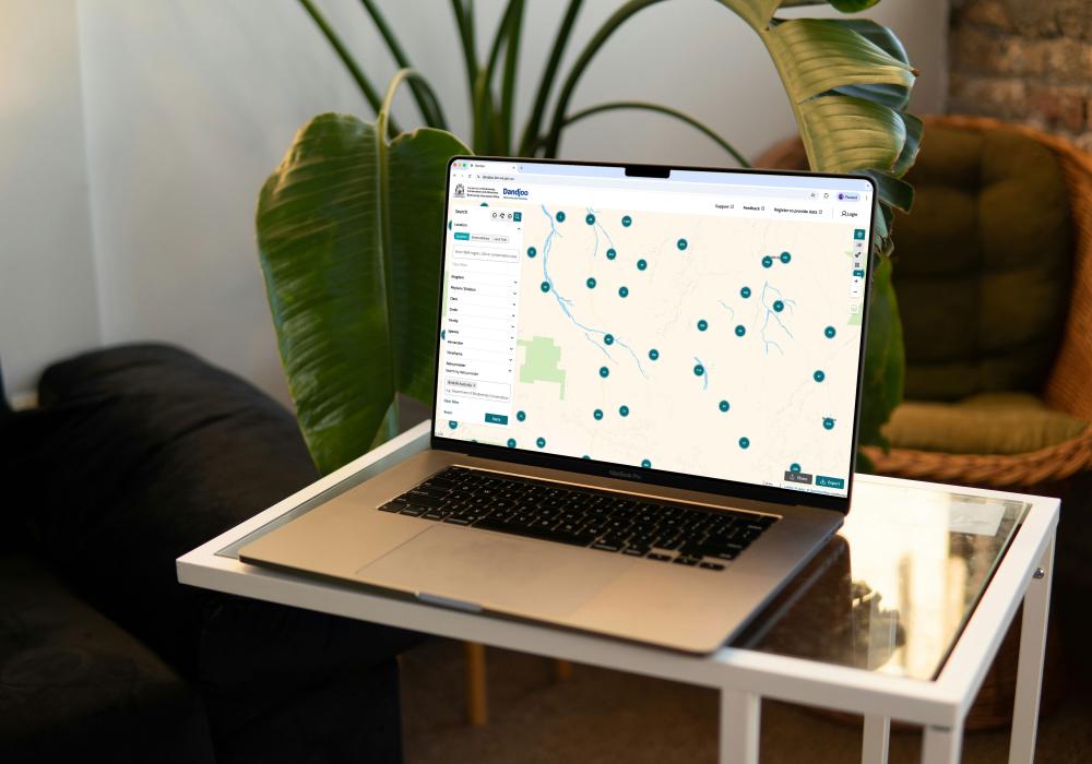
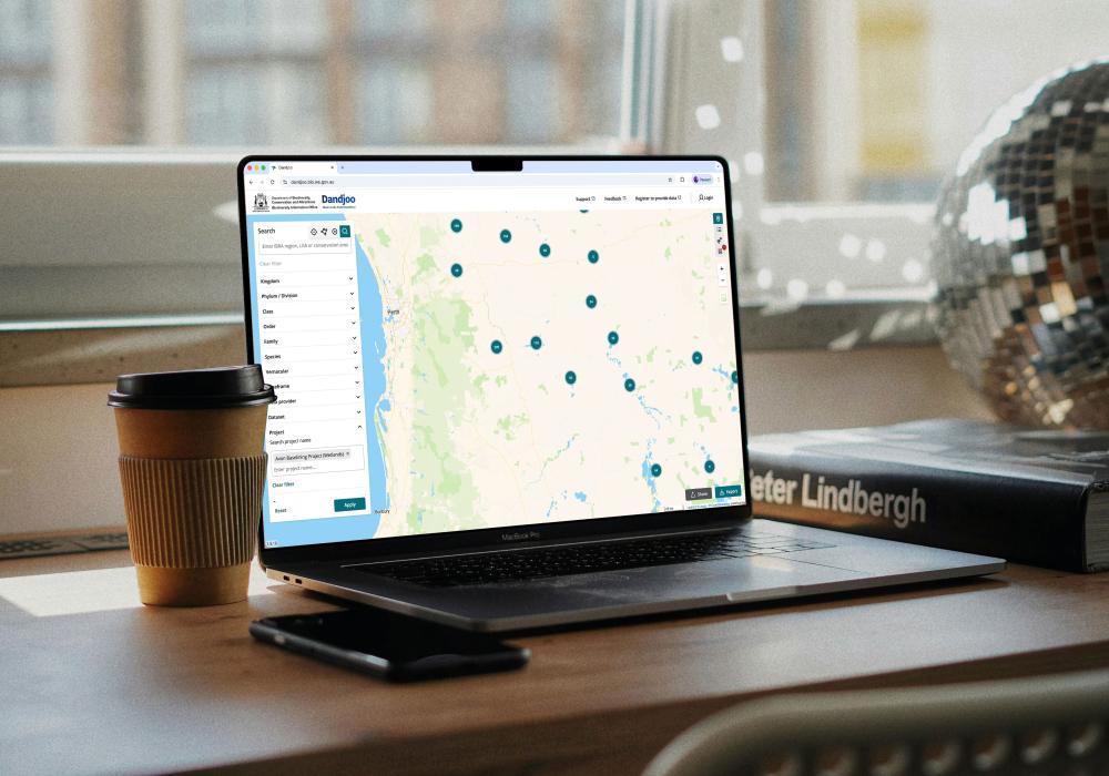
Map view
Displaying species observation records
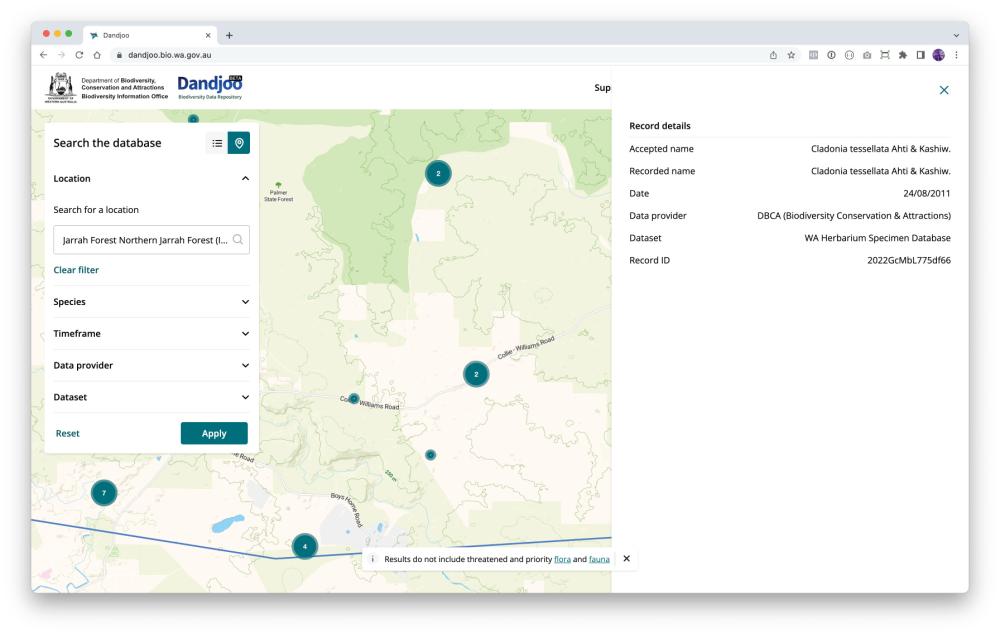
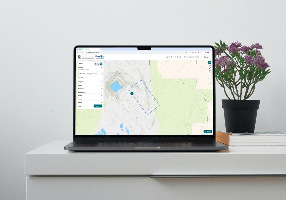
When you search in map view, species observation records will be displayed as clusters of points.
As you zoom in, the clusters will split apart to show more detailed locations. (However, if multiple observations have been recorded at the same location, that cluster will always display the total number of observations.)
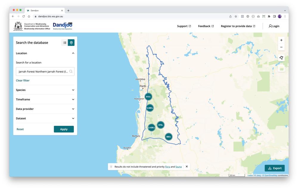
If you would like to view more information about a record, or a cluster of records, just click on it to expand the information panel.
Note that the information panel will only display when you have zoomed in closely to the records you are interested in.
Displaying overlays
Data is more useful with context. We provide a number of overlays you can display on the map, largely sourced from the Western Australia’s open data portal, Data WA.
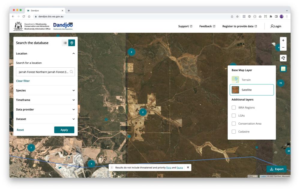
Current overlays in Dandjoo
- IBRA Regions: Bioregions based on the Interim Biogeographic Regionalisation for Australia (IBRA) framework. These regions are key to environmental planning and assist ecological understanding of the land. Interim Biogeographic Regionalisation for Australia (IBRA), Version 7 (Regions) is developed and provided by the Australian Government.
- Local Government Areas: Local government administrative boundaries for gazetted towns, councils, and shires. (Landgate dataset LGATE-233).
- Conservation Areas: Shows DBCA’s ‘Legislated Lands and Waters dataset’, including areas protected under the CALM Act (1984), Swan and Canning Rivers Management Act (2006) and the Land Administration Act (1997). (Department of Biodiversity, Conservation and Attractions dataset DBCA-011).
- Cadastre: The cadastre is a simplified representation of all land parcel boundaries in Western Australia. It provides land ownership information frequently used for property and planning purposes. It is an extremely detailed overly, so you will need to zoom in to see the details. (Landgate dataset LGATE-002)
- Mining Tenements: Shows live tenements in green and pending tenements in blue. Please note that simply because a tenement exists, it does not mean that mining activity is occurring. (Department of Mines, Industry Regulation and Safety dataset DMIRS-003)
- Pastoral Leases: Pastoral leases are leases over Crown land giving a lessee the right to graze livestock on natural vegetation. (Department of Planning, Lands and Heritage dataset DPLH-083)
- Ramsar Wetlands: Boundaries of the nine wetland areas in Western Australia listed as Wetlands of International Importance under the Ramsar Convention. (Department of Biodiversity, Conservation and Attractions dataset DBCA-010)
Viewing vegetation associations
We also provide a vegetation association overlay. Click ‘Vegetation’ in the layer menu to display this layer.
(Note that this is a very detailed overlay, so you may need to wait for it to load depending on your connection speed.)

Dandjoo currently displays submitted vegetation association data as a simple overlay. However, BIO is currently exploring alternative ways of presenting this data in future releases to enhance searchability and navigation.
Drawing your own search area
There are two ways to draw your own search area in Dandjoo’s map view. On the right of the screen, click the ‘Draw a filter’ box and choose one of the two options, polygon search or point search.
Polygon search: Click a series of points to define an enclosed shape. You can also activate and move individual points of your polygon by clicking on them.

Point search: Click on the map to define the centre of your search area and drag your cursor to expand the search area - the radius of the circle is shown as you draw.
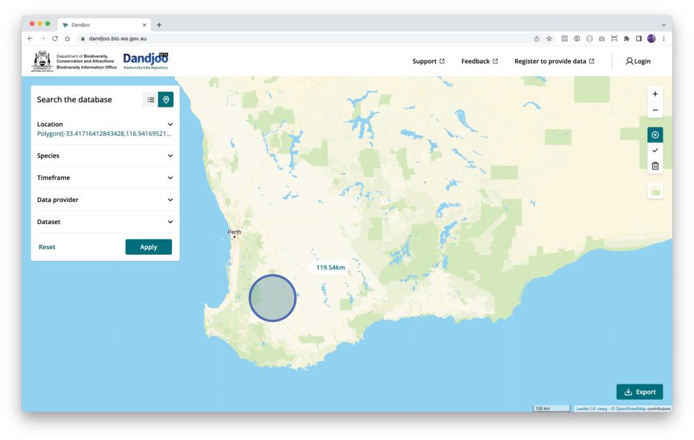
Once you’ve defined your polygon or circle, click the ‘tick’ icon to finalise your search area.
To start again, click the bin icon. (Note that if you have clicked the ‘tick’ icon to lock in your search area, you will need to click the ‘Reset’ button to clear search results.)
Table view
About table view
Table view provides an alternative to Dandjoo's map view for species observation records. It provides a preview of your data that includes a selection of key fields.
(If you would like to access all fields rather than the subset shown in table view, read the Downloading the data section of this guide to learn about exporting your search results, and visit Data standards for more information about the fields that are available.)
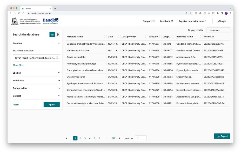
Fields shown in table view
- Accepted name: The current, valid Western Australian scientific name for the organism (or the most recent known name where the current name cannot be determined due to a taxonomic split).
- Date: The date the organism was observed or the sample collected, as submitted by the data provider.
- Data provider: The organisation or individual that submitted the record. The data provider will generally be the owner of the data.
- Latitude: Decimal latitude of the observation (WGS84).
- Longitude: Decimal longitude of the observation (WGS84).
- Recorded name: The scientific name for the organism recorded by the data provider at the time it was observed or sampled.
- Record ID: BIO’s unique identifier for a record - if you have a query about a specific record you can provide this number so we can identify it.
Downloading the data
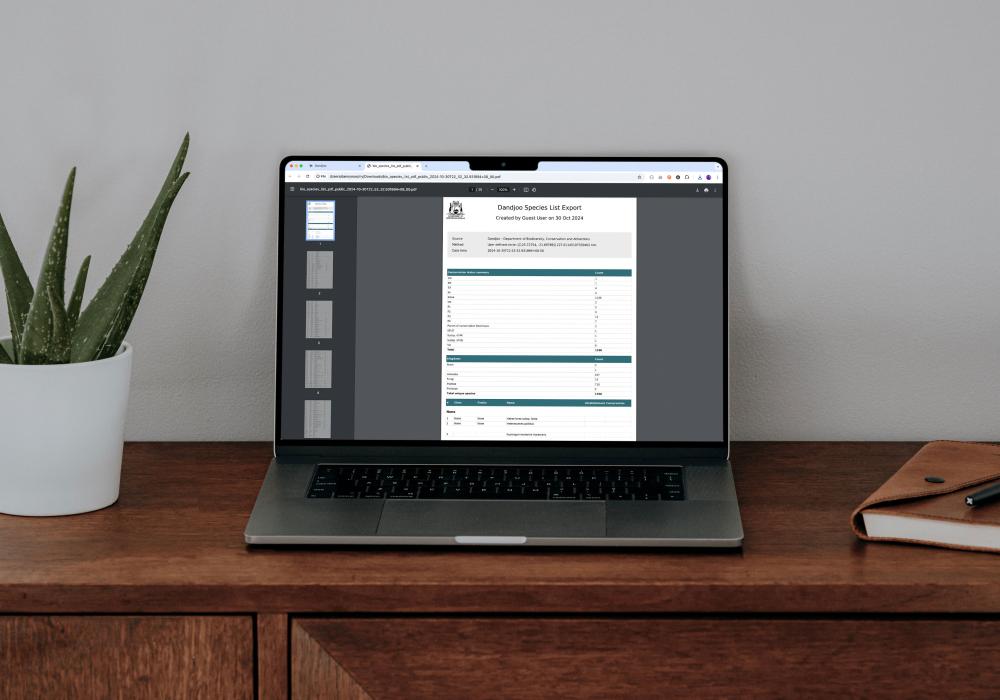
Click on the ‘Export’ button after searching to download the results of your search in .csv or Shapefile format.
Unlike table view, exports contain every standard field in the Dandjoo database - see Data standards for a full list of available fields.
Note that not every data provider will have uploaded values for each optional field. However, every record should contain species names (accepted and recorded), an observation date, and latitude and longitude. Optional fields may be blank where a submitter has not collected or provided them.
Exports are limited to 500,000 records to maintain site performance. However, if you’re interested in downloading more, you can visit our Download Centre to retrieve the most recent snapshot of the Dandjoo species observation database, as well as s snapshot of our vegetation association layer.
If you’re interested in a particular dataset and would like to see all the fields originally submitted - not just the standard Darwin Core fields - contact the BIO team to arrange an extract.
Interpreting the data
When using Dandjoo, it’s important to first consider the context in which data was collected and assess whether it is suitable for your analysis. Take a moment to review the tips below when making this assessment.
Interpretation tips
Presence, absence, and completeness:
Dandjoo currently displays presence data but not absence data.
Records on Dandjoo indicate where field scientists have both looked for, and found, a species - search results are closely related to survey effort in an area.
This means that Dandjoo does not provide a comprehensive overview of all species found within an area. Surveys conducted in the area may have only focused on particular taxa, or an area may not have been surveyed by any of our data providers. In short, if a species does not show on the map, it doesn’t mean the species does not occur there.
However, BIO is exploring ways to ingest and visualise absence data and survey effort data in future releases of the platform.
Abundance:
Dandjoo does provide a count of individuals observed as a standard field, where this information has been submitted by the data provider. If, say, four organisms of the same species were counted when an observation was made, the observation will appear in Dandjoo as a single record with a count of four in this field.
However, Dandjoo is not an ideal tool for assessing abundance, as provision of counts is optional, and counts are not collected at all by some data providers. Additionally, as discussed above, organisms may be present in an area but may not have been recorded or counted.
Conducting a targeted survey will generally be the most appropriate way to rigorously assess abundance.
Data quality and provenance:
BIO does pre-screen data submitters and undertake curation work to enhance data quality. However, the underlying quality of a dataset relies on the work done when the data was collected. If you’re unsure about whether particular data in Dandjoo is fit-for-purpose for your analysis, please do contact BIO for further information.
Guidelines, services and standards
BIO Blog
We have added functionality to be able to search, view and download (where available) Systematic Survey Data in the Dandjoo platform.
Join the BIO newsletter and get updated first
Sign up for access to the latest developments at the Biodiversity Information Office, upcoming Dandjoo features, and our newest datasets.